
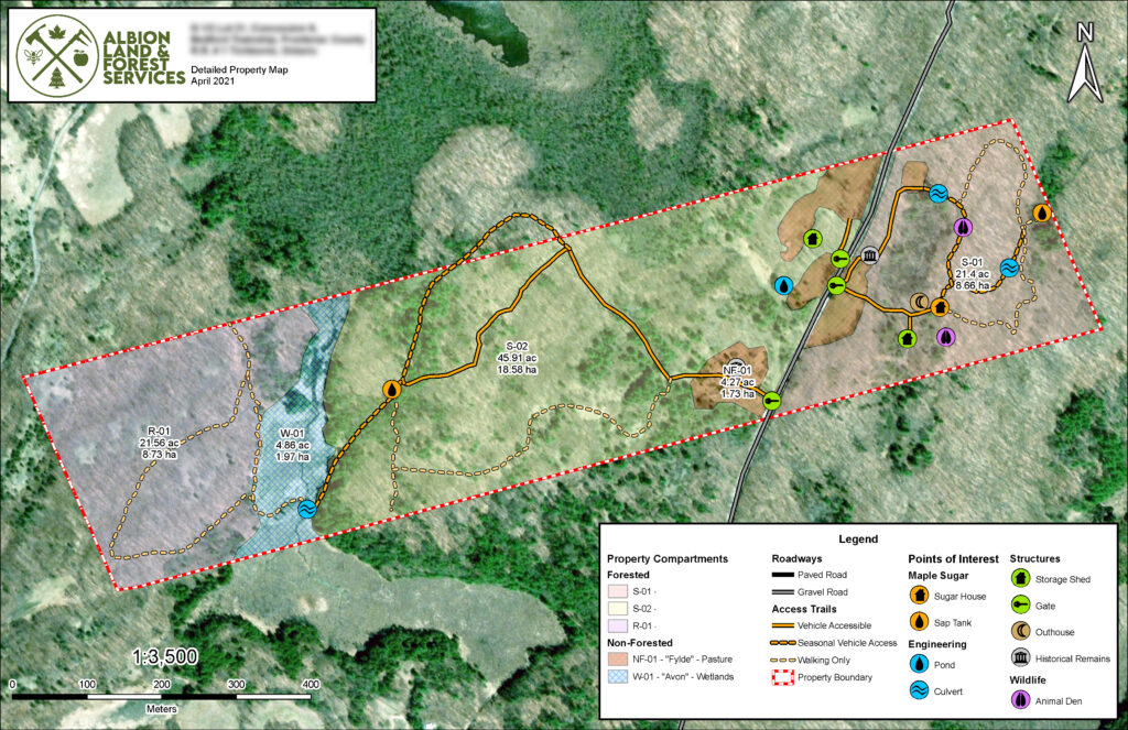
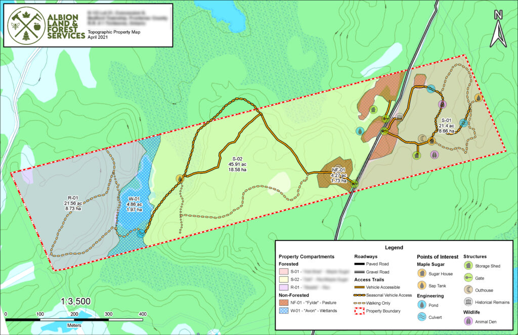
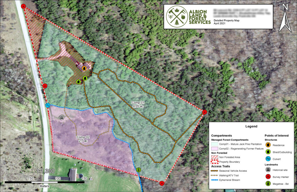
ALFS offers a variety of property mapping services, using the latest industry-standard methods and technologies.
Whether part of an MFTIP Forest Management Plan, or for other land stewardship uses, a quality map is the cornerstone of effective property management. Using satellite imagery and topographic data from a variety of Canadian sources, as well as data gathered on the ground for sites and features unique to your property – we build maps that bring your property to life.
Formats
Maps are available in your choice of formats, including:
Large-format prints – traditional paper copies of your map, available in a variety of sizes and finishes. Lamination also available.
Digital Georeferenced maps – for use with apps such as Avenza that allow you to track your position on the map, make notes, waypoints and other interactive features in real time.
Other Formats – including source data, web graphics, and more are available on inquiry
For more information, or to request a quote for your mapping needs, please contact us at your convenience.